Whether it's romance or water-based recreation you've got in mind, Puerto Vallarta has a stretch of charming cobbled streets and reef systems to satisfy on both counts.
This trail is pleasant to walk down, but walking up is work. Fortunately, there are other options, such as the Elk Creek Trail and the D. & S.N.G. train. The first part of the trail gently descends through some pretty meadows next to the creek. This section of the trail offers excellent views of the Grenadiers and Needles. The trail then begins to drop sharply down the 1,500-ft. descent to the Animas River. All water should be purified, due to problems with Giardia.
Rated good for rainbow and brook trout.
Details
Location:
North of Durango
Setting:
Mountainous
Length:
8 mile roundtrip
Difficulty:
Difficult
Time:
4 to 5 hours
Trailhead Elevation:
10000
Elevation Change:
-1000
Season:
Summer - Fall
Useful Map(s):
USGS Quad: Snowdon Peak
Map + Directions
Basic Directions
1)46 miles north of Durango on U.S. 550 and about 1 mile north of Molas Pass, turn east into the Molas Lake access road. Plenty of parking is available at the trailhead.
2)Access to this trail is also available from the Elk Creek Trail.
Below are the Free Visitor Guides for Durango. More Visitor Guides are available in Mexico. Click here to view them all!
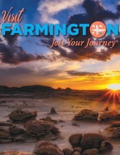
Farmington Northwestern New Mexico
Farmington
Northwestern New MexicoNorthwestern New Mexico is known by many as a magical place. Four Corners and the local Aztec Ruins are considered sacred ground for some and are fascinating to visit. Request this Free Visitor GuideRequested!You're all set! Request a few more Visitor Guides, or complete the form below to receive your guides by mail.
We offer a compact version of Go-Mexico for mobile users, allowing you to access just the information you need on the road. Of course, you can still use the full version of Go-Mexico on your mobile device just as you can on your desktop.